ArcGIS Field Maps
It Works Where You Work
Use Field Maps to explore the maps you make in ArcGIS, collect and update your authoritative data, and record where you’ve gone, all within a single location-aware app.
Key Features
- View high quality maps created using ArcGIS.
- Download maps to your device and work offline.
- Search for features, coordinates, and places.
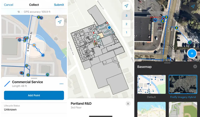
- Collect points, lines, areas, and related data.
- Mark up maps for your own use or to share with others.
- Use professional-grade GPS receivers.
- Collect and update data using the map or GPS (even in the background).
- Fill out easy-to-use, map-driven smart forms.
- Attach photos and videos to your features.
- Record where you've been and share your location.
- Streamline field workflows by integrating with other apps on your device.
Note: This app requires you have an ArcGIS organizational account to collect and update data.
Installation
To install the app onto your device use the links below or search the applicable store for 'ArcGIS Field Maps'.
Apple App Store Google Play Store
ArcGIS Field Maps for Top of the South Maps (TOTSM)
1. Install the app by searching your app store for 'ArcGIS Field Maps' or use the buttons above.
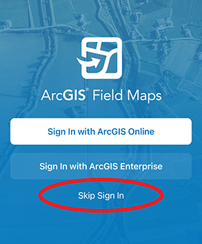
2. Open ArcGIS Field Maps and click 'Skip sign in'
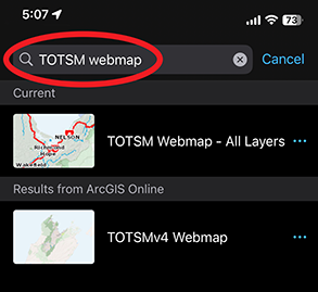
3. Search for ‘TOTSM Webmap – All Layers’ and click on the result.
Note: sometime ArcGIS Field Maps prompts you to sign in when you are searching for 'TOTSM Webmap – All Layers'. If this happens, close the app and follow this link to open the correct map.
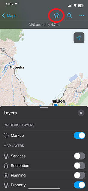
4. The map will open in the app and can now be used for searching and navigation. Click on the ![]() button to turn layers on or off.
button to turn layers on or off.